- Home
- Yooper Counties
- Marquette County Michigan
MARQUETTE COUNTY, MICHIGAN
by Suzy Miller, August 16, 2026
Population: 66,017 (1st)
Pop. Density: 36.25 people/sq. mile (2nd)
Land Area: 1,821 sq. miles (1st)
Water Area: 1,604 sq. miles (4th)
County Seat: Marquette
Towns: Marquette, Arnold, Big Bay, Champion, Gwinn, Harvey, Ishpeming, Little Lake, Michigamme, Negaunee, Palmer, Republic, Skandia
 Marquette County Map
Rand McNally, 1911
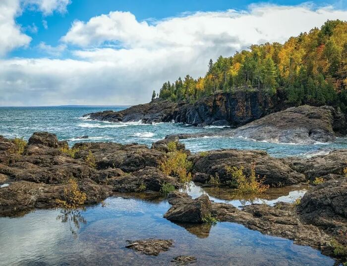
Marquette County stands along the rocky shores of Lake Superior. This north-central stretch of Michigan’s Upper Peninsula mixes deep forests, inland lakes, and a mining past that shaped the region’s character.
It remains the Upper Peninsula’s most populous county and Michigan’s largest by land area.
Marquette County Formation & Naming
The Michigan Legislature set off Marquette County on March 9, 1843, as one of six new counties created in the Upper Peninsula to aid surveying work. It was formally organized in 1851.
The county is named for Jacques Marquette, the French Jesuit missionary and explorer known as Père Marquette. Born in 1637 in Laon, France, he arrived in New France in 1666.
He founded missions at Sault Ste. Marie and St. Ignace, and in 1673 joined Louis Jolliet to explore the upper Mississippi River. He died in 1675 near present-day Ludington while returning from missionary work.
Marquette County Seat & Population
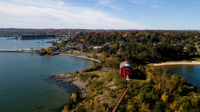
The county seat is the city of Marquette, a harbor community that grew as a shipping point for iron ore. It still anchors the region with its university, waterfront, and outdoor spirit.
As of the 2020 census the population stood at 66,017. The county is the most populous in the Upper Peninsula, with a modestly growing yet still largely rural character spread across its expansive landscape.
History of Marquette County
The Ojibwe (Anishinaabe) people lived along the Carp and Chocolay rivers and the Lake Superior shore for centuries. They relied on fishing, hunting, and seasonal travel.
In 1844 a government survey party led by William A. Burt noticed their magnetic compasses behaving strangely near Teal Lake. The cause was rich iron ore. The discovery launched the Marquette Iron Range.
In 1845-1846 the Jackson Mining Company opened the first mine near present-day Negaunee, and in 1847 a forge on the Carp River produced the first iron.
The settlement that became Marquette began in 1849 as a port for shipping ore. It was first called New Worcester before being renamed in honor of the missionary.


The opening of the Soo Locks in 1855 made large-scale lake shipping practical, and railroads soon followed. Immigrants from Cornwall, Finland, Sweden, Italy, and elsewhere moved in to work the mines and forests.
Charcoal forges gave way to more efficient methods, and production rose steadily through the Civil War and beyond. Cleveland-Cliffs and other companies dominated the industry for generations.
Timber supported the mines and built the growing towns. Though mining has evolved, the iron range continues to define the county’s identity, economy, and sense of place.
The landscape of forests, hills, and Superior shoreline is a living reminder of human effort and natural abundance.
Marquette County - Cities, Towns & Communities
Marquette is the largest city and cultural hub of the Upper Peninsula. It is home to Northern Michigan University and the iconic ore docks that once loaded ships headed for lower-lake steel mills.
Nearby Ishpeming and Negaunee grew directly from the iron mines. Ishpeming hosts the U.S. National Ski Hall of Fame, a nod to the area’s early Scandinavian ski culture.
Smaller communities such as Gwinn, Big Bay, Republic, Champion, and Michigamme offer quieter corners among lakes and woods.
The 47-mile Iron Ore Heritage Trail follows old rail beds past mine ruins and interpretive sites. It quietly links the county’s industrial past with its outdoor present.
Interactive Map of Marquette County
We send out a free newsletter now and then to keep you up to date on our website. Just put in your email and check the boxes below.
By Mike Miller, Copyright 2020-2026 YooperSecrets.com