- Home
- Yooper Counties
- Ontonagon County Michigan
ONTONAGON COUNTY, MICHIGAN
Population: 5,816 (13th)
Pop. Density: 4.43 people/sq. mile (14th)
Land Area: 1,312 sq. miles (3rd)
Water Area: 2,430 sq. miles (3rd)
County Seat: Ontonagon
Towns: Ontonagon, Trout Creek, White Pine
 Ontanagon County Map
Rand McNally, 1911
Ontonagon County occupies a rugged corner of the western Upper Peninsula where thick forests, rushing rivers and the cold blue waters of Lake Superior still dominate the landscape.
It is one of Michigan’s least populated counties, yet its history runs deep - from centuries of Ojibwe presence to copper mines, lumber camps and the preservation of the Porcupine Mountains.
Ontonagon County Formation & Naming
Ontonagon County was set off by the Michigan Legislature on March 9, 1843, as one of six counties created in the Upper Peninsula that year, and it was formally organized in 1848.
The county was named for the Ontonagon River. The origin of the name is Ojibwe, although interpretations vary.
Historical sources connect it with words translated as “hunting river,” while another interpretation traces it to onagon, meaning “dish” or “bowl.”
Ontonagon County County Seat & Population
The county seat is the Village of Ontonagon, located where the Ontonagon River enters Lake Superior.
According to the U.S. Census Bureau's Vintage 2025 estimates, Ontonagon County had 5,823 residents in 2025, compared with 5,816 counted in the 2020 Census.
Despite that recent stability, the county remains remarkably rural and sparsely settled, with forests and wilderness occupying far more land than its communities.
History of Ontonagon County
The Ojibwe people lived along Lake Superior and the Ontonagon River, where fishing, hunting and seasonal travel supported Native communities for nearly a thousand years.
A permanent Ojibwe village once stood near the river's mouth.
French fur traders were among the first Europeans to enter the region. Copper soon attracted greater attention.
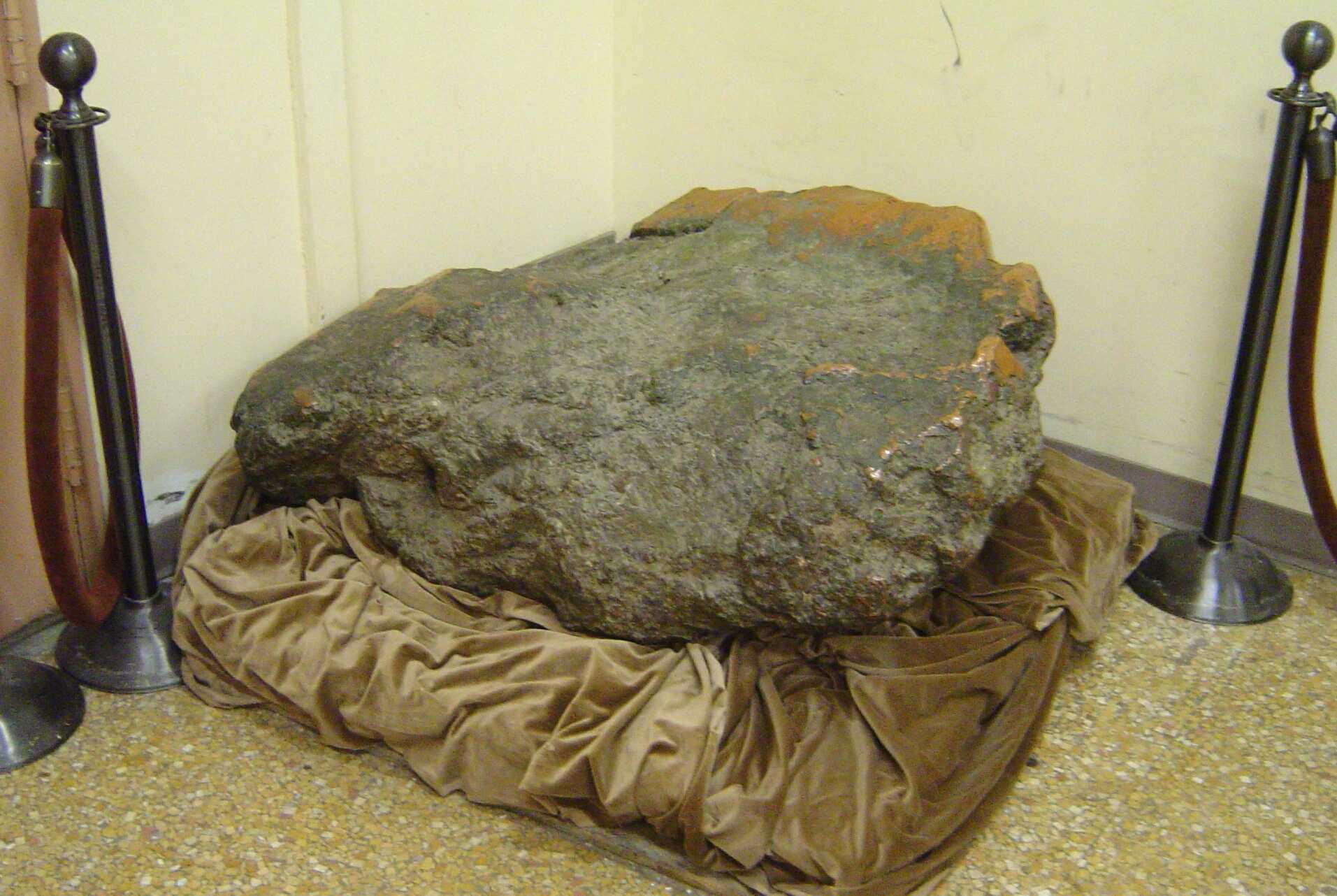
Alexander Henry attempted mining near the Ontonagon River in 1771, and Michigan Territorial Governor Lewis Cass visited the famous Ontonagon Boulder - a massive piece of native copper - in 1820.
The boulder eventually became part of the Smithsonian Institution's collection.
Settlement accelerated during the copper rush of the 1840s. James Paul established himself at the mouth of the Ontonagon River in 1843, and the federal government established a mineral agency there the following year.
The Minesota Mine began operations in 1845, helping make the district an important early center of Michigan copper mining. The Minesota (the single "n" in the name was a mistake in the original incorporation papers) was one of the most productive and famous early mines in the region.
Copper mining was followed by large-scale logging. Beginning in the 1880s, lumber companies harvested the county's pine forests and shipped timber through Ontonagon.
Mining later revived on a huge scale at the White Pine Mine, which operated from 1954 to 1995 and produced ore containing copper and silver.
Meanwhile, preservationists helped save another treasure: the Porcupine Mountains, established as a state park in 1945.
Ontonagon County Cities, Towns & Communities
Ontonagon County has no incorporated cities.
Its largest and best-known community is Ontonagon, while other population centers include White Pine, Rockland, Greenland, Ewen, Bruce Crossing and Bergland. Smaller places such as Matchwood and Trout Creek add to the county's scattered rural character.
Near Rockland, Old Victoria preserves the remains and reconstructed log buildings of an early copper-mining settlement.
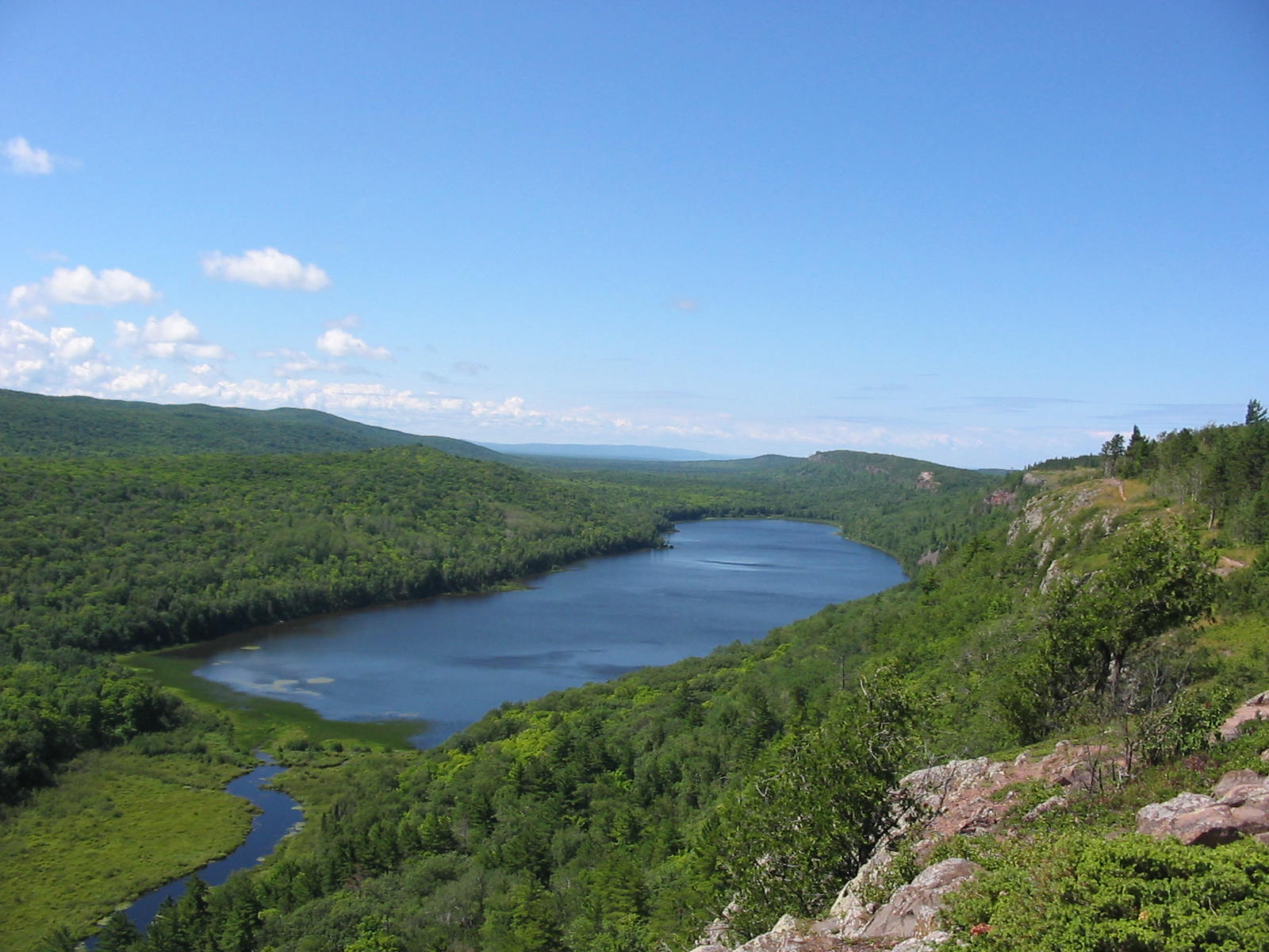


Farther west rise the Porcupine Mountains, or “Porkies,” whose forests, waterfalls and Lake of the Clouds form the centerpiece of Michigan's largest state park.
Ontonagon County is the Upper Peninsula at its most spacious and untamed: a place where abandoned mines and old logging country share the landscape with ancient forests and miles of Lake Superior shoreline.
Its small population belies the outsized role the county has played in the story of Michigan's Copper Country.
Interactive Map of Ontonagon County
We send out a free newsletter now and then to keep you up to date on our website. Just put in your email and check the boxes below.
By Mike Miller, Copyright 2020-2026 YooperSecrets.com