- Home
- Yooper Counties
- Baraga
BARAGA COUNTY, MICHIGAN
by Suzy Miller, August 14, 2026
Population: 8,158 (11th)
Pop. Density: 9.02 people/sq. mile (11th)
Land Area: 904 sq. miles (12th)
Water Area: 165 sq. miles (13th)
County Seat: L'Anse
Towns: Baraga, Covington, Keweenaw Bay, L'Anse, Pelkie, Watton
 Baraga County Map
Rand McNally, 1911
Baraga County is on the southeastern curve of Keweenaw Bay on Lake Superior in Michigan’s Upper Peninsula. The land was shaped by Ojibwe roots, missionary trails, and the steady work of loggers who once filled the forests.
It's home to Michigan’s highest peak and one of the UP’s less-traveled secrets.
Baraga County Formation & Naming
The county was created on February 19, 1875, from the northern territories of Houghton County. It was named for Fredric Baraga, a Slovenian-born Catholic missionary who became the first Bishop of Sault Ste. Marie.
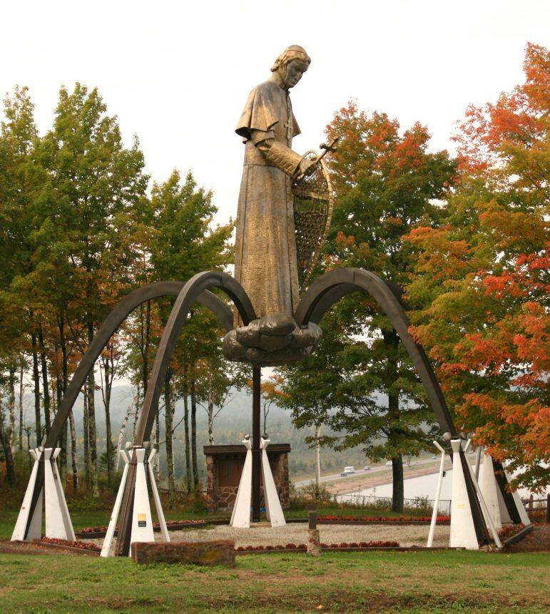
Known affectionately as the "Snowshoe Priest," Baraga spent decades (from 1843 on) traveling the harsh winter terrain on snowshoes to minister to the Ojibwe people and early settlers.
A massive statue of Bishop Baraga overlooks the bay from a high bluff.

Baraga County Seat & Population
The county seat is L’Anse, on the southern shore of Keweenaw Bay. The 2020 U.S. Census recorded 8,158 residents in Baraga County.
Baraga ranks among Michigan’s least populous counties with communities clustered along the bay shore. It’s very rural and sparsely settled.
Much of its landscape is covered by water and wild, untouched forest.
History of Baraga County
This territory was the ancestral home of the Ojibwe people long before the county lines were drawn. The arrival of Frederic Baraga in 1843 marked a turning point, as he established the Holy Name Mission at Assinins.
The permanent European settlement focused on education and conversion. While the fur trade had previously brought transient traders to the region, Baraga’s mission anchored the community.
The blend of Native American and Catholic traditions lingers today.
Unlike its neighbor to the west, Baraga County never experienced a massive copper boom. The economy relied more heavily on logging, with vast white pine forests fueling mills in L'Anse and Baraga.
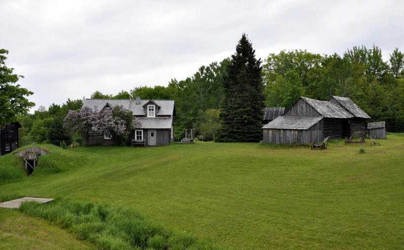 Hanka Finnish Homestead House and Barn in Baraga County, MI
Photo courtesy of hankahomesteadmuseum.org

In the 1920s Henry Ford acquired large timber holdings, including the community of Pequaming. He later built the model sawmill village of Alberta, and experimented with slate quarrying in Arvon.
Railroads carried lumber south while ships moved it across the Great Lakes. After the big timber was cut, the industry faded.
The L’Anse Indian Reservation of the Keweenaw Bay Indian Community remains a vital part of the county, and the economy has shifted toward tourism, manufacturing, government services, and the casino.
Today, the county’s history is preserved in sites like the Hanka Finnish Homestead and the Bishop Baraga Shrine. The Ottawa National Forest covers portions of the southern area.
Baraga County - Cities, Towns & Communities
Main communities include the county seat of L'Anse and the village of Baraga, which sits just west along the bay.
Smaller communities are Skanee on Huron Bay, Zeba, Pelkie, Covington, and Assinins, the site of Baraga’s original mission. The area shows its Finnish and Native American roots.
A true Yooper secret lies near the town of Alberta, where Henry Ford’s experimental village is preserved as a ghost town of sorts, complete with a historic sawmill.
The county notably has Mount Arvon, the highest point in Michigan at 1,979 feet. Luckily, it lacks the crowds found at more famous peaks.
Interactive Map of Baraga County
We send out a free newsletter now and then to keep you up to date on our website. Just put in your email and check the boxes below.
By Mike Miller, Copyright 2020-2026 YooperSecrets.com