- Home
- Yooper Counties
- Gogebic County Michigan
GOGEBIC COUNTY, MICHIGAN
by Suzy Miller, August 15, 2026
Population: 14,380 (7th)
Pop. Density: 13.06 people/sq. mile (7th)
Land Area: 1,101 sq. miles (7th)
Water Area: 375 sq. miles (11th)
County Seat: Bessemer
Towns: Bessemer, Ironwood, Marenisco, Ramsay, Wakefield, Watersmeet
 Gogebic County Map
Rand McNally, 1911
Rugged and remote Gogebic County is at the far western tip of Michigan’s Upper Peninsula. The land meets Wisconsin while Lake Superior’s shoreline stretches north.
Thick forests, inland lakes, and the remnants of an iron boom define this corner of Yooper country. It is Michigan’s westernmost county and one of only four completely in the Central Time Zone.
Gogebic County Formation & Naming
Gogebic County was organized on February 7, 1887, when the Michigan Legislature partitioned it from Ontonagon County.
The name comes from Lake Gogebic, the largest inland lake in the Upper Peninsula (excluding the Great Lakes, of course).
The original Ojibwe name was Agogebic, though the exact meaning is uncertain. One common interpretation is “body of water hanging on high,” due to the lake’s elevated position created by ancient glaciers.
Gogebic County Seat & Population
Bessemer is the county seat. The city grew with the early iron mines and still holds the historic courthouse. The 2020 U.S. Census recorded 14,380 residents in Gogebic County.
Its population density is roughly 13 people per square mile. It remains rural and has seen a gradual decline in population over recent decades.
History of Gogebic County
These lands were traveled by the Ojibwe people for centuries. They used the region for its rich natural resources and strategic waterways.
The modern history of Gogebic County began in 1871 when Professor Raphael Pumpelly discovered iron ore near the Montreal River.
This discovery sparked a frenzy of exploration, leading to the 1884 opening of the first commercial mine, the Colby Mine.
After the railroad reached the area, the Gogebic Iron Range really opened up. A rapid boom followed. Mines like the Norrie and Newport drew workers, and towns sprang up almost overnight.
The diverse wave of immigrants included Cornish miners, Finnish loggers, and Italian families, who built the towns of Ironwood, Bessemer, and Wakefield.
Ore moved by rail to the docks at Ashland, Wisconsin, and other ports for shipment to steel mills. At its peak the range produced millions of tons annually and helped fuel industrial growth.


Lumbering also played a critical role, with vast stands of white pine harvested to support the mines and build the growing Midwest.
Mining lasted about eighty years, from the 1880s until the last major operations closed in the mid-1960s. The population rose and fell with the industry.
After the mines shut down, the economy shifted toward timber, outdoor recreation, and tourism.
The Ottawa National Forest covers large portions of the county, and the Lac Vieux Desert Indian Reservation remains in Watersmeet Township.
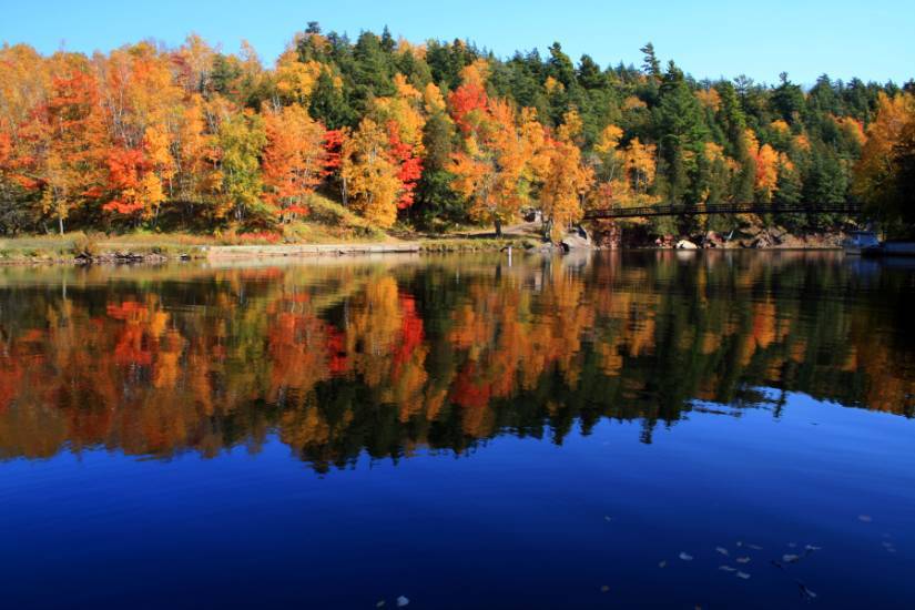
Lake Gogebic and dozens of smaller lakes and waterfalls add to the natural beauty of the area.
Gogebic County - Cities, Towns & Communities
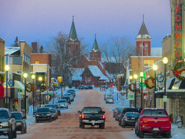
The largest city is the commercial hub of Ironwood near the Wisconsin border. It's known for its charming downtown and historic architecture.
Other key communities include the county seat of Bessemer, the mining town of Wakefield, and the lakeside village of Marenisco.
Smaller settlements include Ramsay, Watersmeet, and the unincorporated community of Anvil.
A true Yooper secret lies just north of these towns: the county shares the breathtaking Lake of the Clouds with a neighboring county.
It's an alpine-like lake high in the Porcupine Mountains (the Porkies) with some of the most spectacular views in the Midwest.
Another enduring local attraction is Lake Gogebic itself, whose high elevation and clear waters still draw visitors and remains central to the county’s identity.
Interactive Map of Gogebic County
We send out a free newsletter now and then to keep you up to date on our website. Just put in your email and check the boxes below.
By Mike Miller, Copyright 2020-2026 YooperSecrets.com